Petropolis
106 Boulder Problems
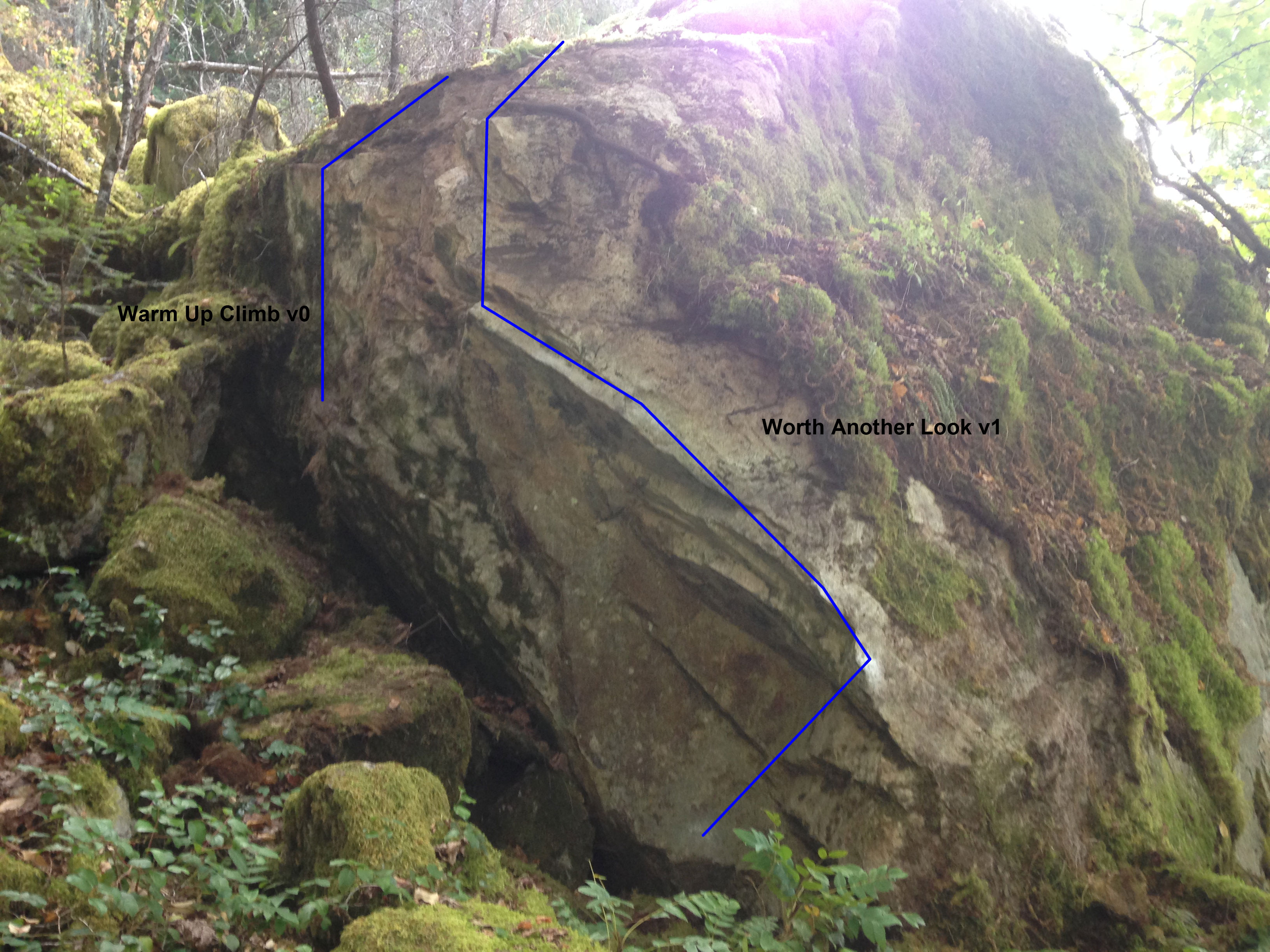
Description:
There are tons of boulders out here and many of them have yet to be developed. The rock is the same glassy basalt as the rock in Cyberia but of arguably better quality.
The approach is somewhat long, roughly 40 minutes, but it is beautiful. Winding uphill and overlooking Brentwood Bay the approach takes you up to the Malahat viewpoint trail where dozens of massive boulders sit gathering moss. Partially developed around 2009 and then seemingly forgotten there are a multitude of established problems including several excellent highball problems. Unfortunately because of how little traffic this area has seen there is a fair bit of moss on the boulders so anyone trekking out there ought to bring a wire brush! I cannot recommend this area enough. I was blown away when I went up there. It is the same type of rock as Cyberia but arguably better quality and in a stunning location. Interestingly the boulders prevented the logging of old growth forest trees in the area so the boulders are surrounded by massive trees! Don’t let the long hike dissuade you! Get out there! This place should be on everyone’s radar!
Directions / Travel Info:
Park at the Cascade Trailhead on Ross Durrance Rd and hike along what google maps calls the Cascade Trail (though on this map and Google Maps it shows it as Timberman’s Trail - I do not know what the correct name is). Shortly after you cross a wooden bridge/creek take the left branch / stay on the main path of the Timberman’s trail) [coordinates (48.550724, -123.502327)]. After a few mins you will begin a steady uphill hike. Continue along this trail until the slightly unobvious turnoff right onto the Malahat Viewpoint Trail [coordinates (48.548303, -123.512154)]. After 3 minutes, take a left onto a trail which will keep you on the Malahat Viewpoint Trail. (48°33'02.6"N 123°30'08.4"W) - do not continue straight ahead on the more obvious path that heads directly downhill to the ocean. This section of the Malahat Viewpoint Trail goes uphill for a bit and then runs parallel to a hill on the left for a total of 7 mins. The trail takes you to a beautiful lookout point of the bay which is identified as the Malahat Viewpoint (48.54664541119138, -123.51846846196344) on the BC Park's signage at the start of the hike and in the All Trails App but the viewpoint is not IDed in Google Maps as of Aug 2024. At the viewpoint, do not continue down the mossy outcrops to your left/west. Behind you will be a smaller trail that will head downhill which will have the steepest gradient of the whole hike (the trail is called the Malahat Viewpoint Trail in Google Maps but it is called the Middle Trail in the All Trails Map). After about 5 mins you will start to see boulders on your left [coordinates (48.546621, -123.518932)]. Note: you will have cell service throughout the whole hike. When in doubt, if you are using Google Maps, you should never stray very far off the Timberman Trail for the firsts 3/4 of the hike and the Malahat Viewpoint Trail for the last section of the hike.
View on Google MapsLatest Sends
-
 Dirty Dancing, V2Connor Melanson (redpoint) 2025-07-01
 -
 Straight Up, V2Greg Bauch (redpoint) 2025-06-06
 -
 Straight Up, V2Nicolas (redpoint) 2025-06-06
 -
Flaming lip, V1Greg Bauch (redpoint) 2025-06-06
-
Greg Bauch (redpoint) 2025-06-06


